
More than 200 years ago (on June 30, 1805), the Michigan Territory was incorporated within the United States, existing until January 26, 1836, when Michigan became the 26th state admitted to the Union. At that time in Michigan’s history, there were 38 counties already established here – with over 13% of the state’s 174,543 inhabitants living in Wayne County. Most of the people were located in the Detroit area (Wayne, Washtenaw, Oakland and Lenawee counties).
As the population grew, Michilimackinac County – which encompassed the Upper Peninsula and most of the northern Lower Peninsula – were platted into smaller counties. In many cases, the boundary lines differ from what we recognize today.
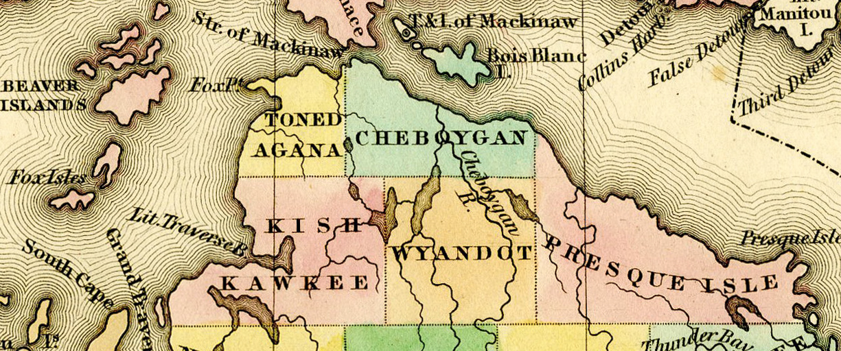
In April of 1840, Tonedagana County (named after an Odawa Chief from Cross Village) split from Mackinac County (the shortened name for Michilimackinac). The southern boundary of this county was located near the northern section of M-119 (between Cross Village and Levering). Tonedagana was renamed Emmet County on March 8, 1843 (after Robert Emmet) although it remained attached to Mackinac County for administrative purposes until county government was organized in 1853.
That same year, nearby Kesk-Kauko (also spelled Kish Kawkee or Resh-Kanko) County was organized and named for a great chief of the Saginaw Tribe, connecting with Tonedagana north of Douglas Lake. In 1843, the county was renamed for Jesuit missionary Pierre Francois Xavier de Charlevoix.
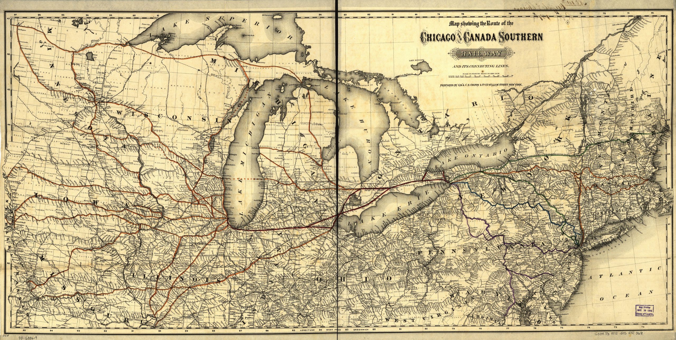
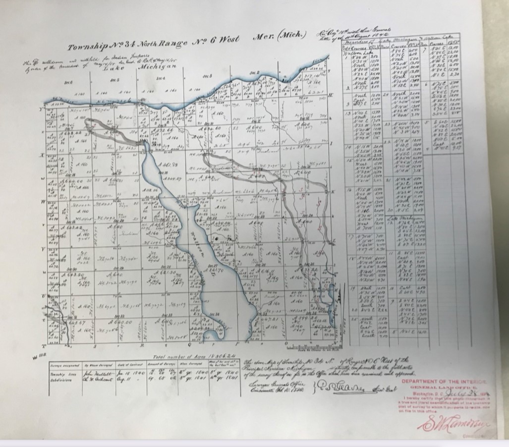
These original county names appear in early maps of the area although over the years, the maps didn’t always reflect the standing names. Between 1840-1841, three men – William Austin Burt (for whom Burt Lake was named), Charles W. Cathcart and John Mullett (for whom Mullett Lake was named) – traveled to northwest Michigan to survey land and establish Northern Michigan townships.
Maps with Mullett and Cathcart’s signatures are archived at the Bentley Historical Library at the University of Michigan. It is these maps where Walloon Lake is first printed as the lake’s name. The map denotes that the surveying itself took place in the second quarter of 1840, although it wasn’t registered until February 10, 1842 at the Surveyor General Office in Cleveland.
“In an effort to learn why the surveyor, Charles W. Cathcart, chose the name Walloon, a letter was written to R.T. Tucker, Acting Chef, Land Division of the Department of Natural Resources,” according to the 1984 book Muhqua Nebis – A Compilation of Legends of Walloon by Dorothy Munson Krenrich (page 4). “Mr. Cathcart’s field notes were devoid of any information regarding this subject. None of the crew members had the name Walloon and no mention as made of any settlement in the area with this name.”
A few years later, in 1844, a map was printed by Morse & Breese which showed Emmet and Charlevoix with their new names (although the boundaries reflect those in the 1842 map above). What is missing from this map is Walloon Lake – well, at least by that name. When you zoom in on this map, the lake is identified as Punapun Lake. A search on Google was quick and uninformative. Not a single reference to any lake, community or anything named Punapun.
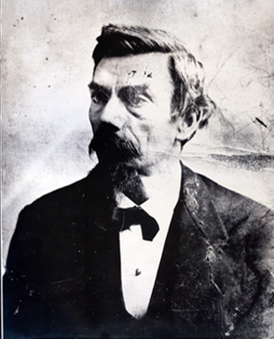
Things in this region took an interesting turn in 1847, when a group of Mormons – under the direction of self-proclaimed “King” James Jesse Strang – established a colony on Beaver Island (off the coast of the city of Charlevoix, in Charlevoix County). As if running his own kingdom wasn’t enough, Strang campaigned and was elected as a Democratic member of the House of Representatives in 1853 (and again in 1855).
One of his first duties in office was the ushering in of Act No. 18 of the Sessions Laws of 1853 – “An act to organize the County of Emmet” – which ultimately enlarged Emmet County by attaching the nearby Lake Michigan islands as well as a portion of Cheboygan County and Charlevoix (Kesk-kauko/Resh-kanko). This gerrymandering act meant a larger constituency for the power-hungry Strang. Subsequently Charlevoix was organized as a township under Emmet County and consisted all of the nine townships in the southern half of Emmet County.
This new jurisdiction was short lived, however. “Due in large part to fear of and animosity towards Strang’s religious sect, and concerns over the political strength his following gave him, petitions were presented to the legislature to detach Beaver and the Fox Islands from Emmet and form them into a separate county. This was granted in 1855. The Manitou Islands [part of Leelanau County] were included in the new county and gave it their name, despite being nearly unpopulated at the time,” according to Wikipedia. The insular Manitou County existed for just 40 years, until 1895, and included all the islands in the Beaver Island Archipelago, North and South Manitou Islands and the Fox Islands, with the county seat being St. James on Beaver Island.
Strang held his House seat and his Mormon throne until January 9, 1856, when he was assassinated by former disgruntled followers.
Back to Walloon Lake…which was still undergoing a bit of an identify crisis during the latter half of the nineteenth century. An 1849 map by John Farmer identifies this majestic body of water as Muhqua – which is the Native American word for bear and for decades, the name Bear Lake seemed to stick (showing up on railroad maps through the early 1880s).
The first homesteaders to this area were John Jones Jr., and his sons (Clarence and Elliot) in 1872. As the logging era came to a close, the Grand Rapids and Indiana Railroad began operation and brought a new industry to the region: tourism. The first railway stop here was named Melrose (reflective of today’s Melrose Township).
In order to establish a community, a post office was in order and the handful of locals who had congregated here submitted their federal application using the name Bear Lake (given the maps had referred to the lake by this name for years, and the Bear Creek flows out from the lake itself). Unfortunately, another city in Michigan (in Manistee County) had already snagged that name in 1865. Locals here settled on Tolcott as the new community name, established in October 1897. In March of 1899, the name was changed slightly to Talcott – meaning “cottage near the lake” (a name now given to the village’s downtown event space The Talcott).
Yet, the name would change once more and in September 1900, Walloon Lake was chosen – finally catching up with that 1841 map. It is said J.R. Hass, a local butcher, had seen the name on an old railroad map. Further digging revealed that many years earlier a settlement of Walloons had been identified at the north end of the lake. Walloons are a “Romance ethnic group” native to Belgium, principally in the southern region of Wallonia. Primarily French speaking, they share a common ancestry, religion, language, traditions and folklore.
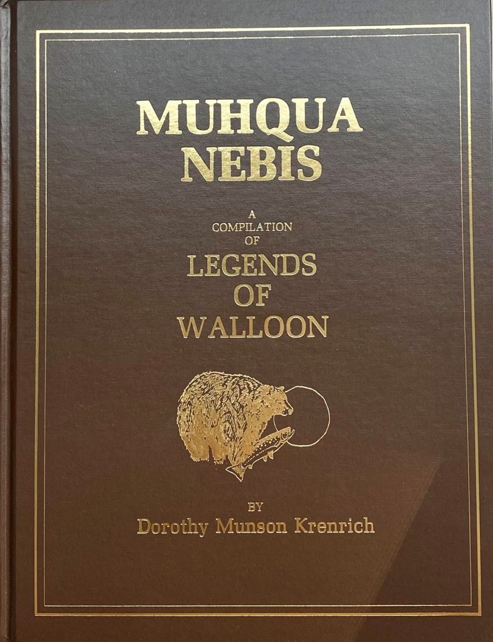
Muhqua Nebis also includes a reference (page 5) to general store near present day Camp Michigania with a wooden sign that read “Walloon Lake” that hung on the porch. The store stood on a tract of land purchased in 1881 by A.W. Olds, who also built a large family home in this area as well as cabins for mill workers.
“Elizabeth Schneider, who died at age 99 in 1983, was a child at the time her family occupied one of the cabins. She told of seeing this sign. Was this ‘city’ named after the official, though unused name of the lake, or did Mr. Olds, by chance, while excavating for the buildings, unearth some evidence to indicate there had been a Belgian settlement on the site?”
While the official village name didn’t become Walloon Lake until 1900, businesses in the area boasted the name for decades prior. Mr. Olds opened a broom handle factory at the head of the lake in 1881 – called Walloon Lake Manufacturing Co.; Mrs. James Haas ran a boarding house in the 1890s called Walloon Hotel and in 1900, Alfred Haas opened the New Walloon hotel, located near the downtown steamer dock.
No matter when, who or how Walloon came to be, we are proud to call Walloon Lake home – our village and our lake! We believe this is the only community bearing the name Walloon, although 3.644 million people call the Wallonia region of Belgium their home.

The James Farmer map has always been a favorite of mine. Thanks for this piece of history..